

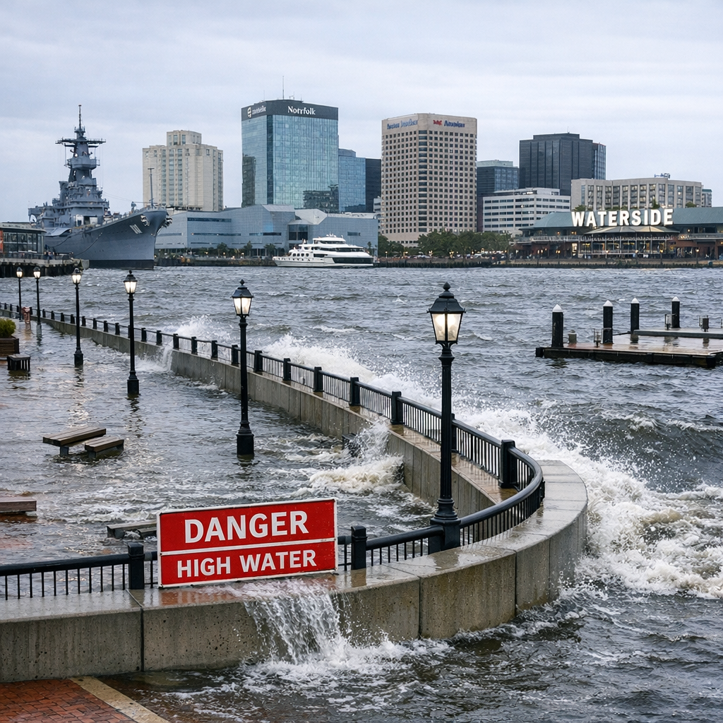
Hi, I’m Andrew Mitchell with Local Voices. Norfolk’s weather and environment aren’t just patterns on a forecast—they shape everyday life, especially in a city where water is never far away. Let’s break down the seasonal rhythms, flood risks, and what’s being done to build a resilient Norfolk.
Seasonal Patterns You’ll Feel
Norfolk has a humid subtropical climate. Summers are hot and muggy, with average highs near 89°F in July. Despite temperatures often feeling oppressive along the rivers and waterfront, the nearby Chesapeake Bay and Atlantic Ocean help moderate extremes, making nights slightly more bearable. Winters are mild—average highs in the upper 40s to mid-50s, lows occasionally dipping near freezing. Snow is rare and light.
Rainfall is spread through the year, though it peaks from July through early September. Thunderstorms are common during summer, and tropical storms or their remnants sometimes brush or hit the region during late summer and early fall.
Why Flooding is a Constant Concern
Norfolk’s elevation and geography make it especially vulnerable. The city sits largely below 15 feet above sea level, surrounded by bays, rivers, and tidal waterways. With sea level rise occurring and land subsidence contributing, what used to be rare coastal flooding and storm surge are becoming more frequent.
There are three main types of flooding Norfolk faces:
- Tidal flooding: Happens during high tides—especially when combined with full moons or strong winds.
- Storm surge flooding: Tied to hurricanes or nor’easters pushing water inland.
- Precipitation flooding: Heavy rain overwhelming drainage systems, particularly in lower-lying neighborhoods.
What’s Being Done—and What You Can Do
The City of Norfolk has several initiatives in progress to combat flooding risks and environmental pressures:
- Norfolk Coastal Storm Risk Management (CSRM) is a major project funded in part by the Bipartisan Infrastructure Law. It includes storm surge barriers, levees, and pump stations.
- Flood awareness and mitigation strategies help residents understand flood zones, protect their property, and make sense of flood insurance.
- Green infrastructure plans are integrating trees, shoreline defenses, wetlands, and stormwater systems to reduce runoff, absorb floodwaters, and protect habitats.
As a resident, you can help by staying alert—sign up for alerts, know your flood risk zone, protect your own property, support green space, or explore flood mitigation options for your home—like raising utilities or landscaping for better drainage.
Looking Ahead
With projections showing sea levels continuing to rise locally, Norfolk could see a growing number of high-tide floods, even without storms. What once were occasional nuisances may become common occurrences. That means home preparations, community planning, and infrastructure investments matter now more than ever.
Weather will always bring surprises, but knowing the norms and risks—and watching new efforts to adapt—helps us not just weather the storms, but live in this city with confidence.